Beale Wagon Road
-
In Search of Lost Highways
Recently I set out in search of lost highways in Coyote Pass. In this picturesque wonderland…
-
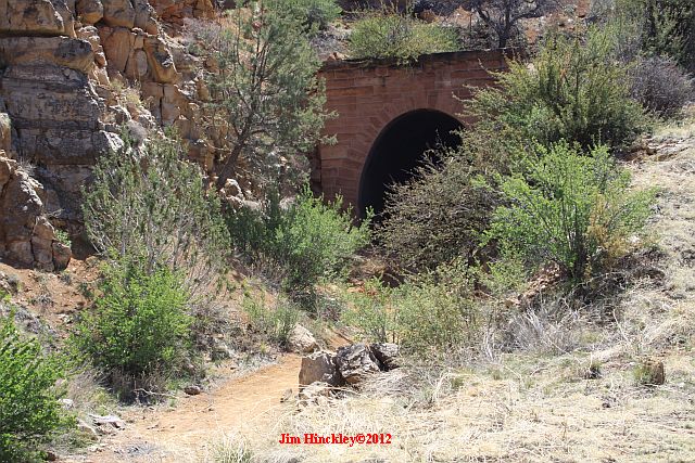
Dusty Trails And Lost Highways
Beale Springs in the foothills of the Cerbat Mountains in western Arizona is more than a…
-
Lost Highways, Old Friends & And A Hearty Breakfast
What do you call a day that includes a Route 66 road trip, an awesome possum…
-
Dusty Trails, Forgotten Rails, And An Old Road Signed With Two Sixes
This morning I have what is hoped to be an exciting post that will encourage an…